


Ahmedabad
(Head Office)Address : 506, 3rd EYE THREE (III), Opp. Induben Khakhrawala, Girish Cold Drink Cross Road, CG Road, Navrangpura, Ahmedabad, 380009.
Mobile : 8469231587 / 9586028957
Telephone : 079-40098991
E-mail: dics.upsc@gmail.com
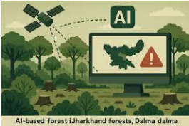
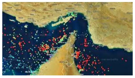
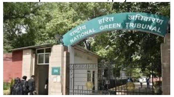
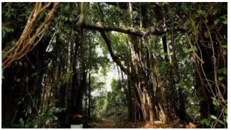
• Halt of Anavaran System: The Forest Survey of India (FSI) has suspended its fortnightly deforestation alerts issued via the \'Anavaran\' portal, which had been operational since January 2024. The system has not been updated since November 2025, with officials describing it as a pilot project currently under utility assessment. • Technological Edge: Anavaran utilized Machine Learning (ML) and satellite data from Sentinel-2 (optical) and Sentinel-1 (Synthetic Aperture Radar) to detect forest cover loss at a high spatial resolution of 10-20 meters. This provided \'near-real-time\' alerts compared to global systems like Terra-I, which often operate at lower resolutions. • Operational Impact: During its 22-month run, the system issued over 12,000 alerts. Data indicates that deforestation peaks during the November-March period due to favorable weather for manmade activities. States like Punjab, Andhra Pradesh, and Arunachal Pradesh recorded the highest number of alerts. • Methodology of Detection: The algorithm used Google Earth Engine to compare current images with historical reference values for the same month. Any significant deviation flagged a unique patch of deforestation, sending precise coordinates to state forest departments for field verification. • Synergy with Van Agni: The deforestation alert system was modeled after the successful \'Van Agni\' portal for forest fires. While the fire alert system has been refined over two decades, the deforestation module was intended to be the next logical step in leveraging satellite-based conservation. • Conservation Gaps: Experts highlight that the suspension creates a monitoring vacuum, as state forest departments relied on these automated alerts to bypass the limitations of manual patrolling in remote and dense terrains. Key Definitions • Anavaran-Deforestation Alert System: A satellite-based monitoring tool developed by the FSI to provide fortnightly location-specific alerts on forest cover change using remote sensing. • Synthetic Aperture Radar (SAR): A form of radar used to create 2D or 3D reconstructions of objects; it is crucial for forest monitoring as it can \'see\' through clouds and smoke, unlike optical sensors. • Spatial Resolution: Refers to the size of the smallest feature that can be detected by a satellite sensor; 10-meter resolution means each pixel represents a 10m x 10m area on the ground. Constitutional & Legal Framework • Article 48A: A Directive Principle of State Policy (DPSP) that mandates the State to endeavor to protect and improve the environment and to safeguard the forests and wildlife of the country. • Article 51A(g): A Fundamental Duty of every citizen to protect and improve the natural environment including forests, lakes, rivers, and wildlife. • Forest (Conservation) Act, 1980: The primary legislation regulating the diversion of forest land for non-forest purposes; real-time monitoring is essential to detect illegal diversions under this Act. • The Indian Forest Act, 1927: Provides the legal framework for the protection of Reserved and Protected forests, where the FSI\'s alerts act as evidentiary support for enforcement. Additional Important Keypoints • State Performance: Significant deforestation activity was noted in the Northeast (Arunachal, Nagaland, Manipur), highlighting the region\'s vulnerability to shifting cultivation and infrastructure projects. • Sentinel Satellites: Part of the European Space Agency’s (ESA) Copernicus programme, these satellites provide the open-access data that fuels India\'s FSI monitoring capabilities. • Machine Learning Utility: ML allows for the automated filtering of seasonal changes (like deciduous leaf fall) versus actual forest clearing, reducing false positives in alerts. Conclusion The pause in the Anavaran system represents a temporary setback in India\'s transition toward data-driven environmental governance. While the FSI evaluates the pilot\'s utility, the high volume of alerts generated suggests that automated, high-resolution monitoring is no longer a luxury but a necessity for forest protection. Reinstating and refining this AI-led tool is vital for India to meet its international commitments under the Paris Agreement and the Bonn Challenge. UPSC Relevance • GS Paper III: Environment and Biodiversity (Conservation); Science and Technology (Applications of Remote Sensing and AI); Internal Security (Enforcement of forest laws). • GS Paper II: Statutory and Quasi-judicial bodies (Forest Survey of India). • Prelims: India State of Forest Report (ISFR), Satellite missions (Sentinel, RISAT), and legal provisions of the Forest Conservation Act.

Address : 506, 3rd EYE THREE (III), Opp. Induben Khakhrawala, Girish Cold Drink Cross Road, CG Road, Navrangpura, Ahmedabad, 380009.
Mobile : 8469231587 / 9586028957
Telephone : 079-40098991
E-mail: dics.upsc@gmail.com
Address: A-306, The Landmark, Urjanagar-1, Opp. Spicy Street, Kudasan – Por Road, Kudasan, Gandhinagar – 382421
Mobile : 9723832444 / 9723932444
E-mail: dics.gnagar@gmail.com
Address: 2nd Floor, 9 Shivali Society, L&T Circle, opp. Ratri Bazar, Karelibaugh, Vadodara, 390018
Mobile : 9725692037 / 9725692054
E-mail: dics.vadodara@gmail.com
Address: 403, Raj Victoria, Opp. Pal Walkway, Near Galaxy Circle, Pal, Surat-394510
Mobile : 8401031583 / 8401031587
E-mail: dics.surat@gmail.com
Address: 303,305 K 158 Complex Above Magson, Sindhubhavan Road Ahmedabad-380059
Mobile : 9974751177 / 8469231587
E-mail: dicssbr@gmail.com
Address: 57/17, 2nd Floor, Old Rajinder Nagar Market, Bada Bazaar Marg, Delhi-60
Mobile : 9104830862 / 9104830865
E-mail: dics.newdelhi@gmail.com